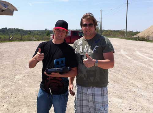
When they began their academic adventures at the University of Lethbridge, co-owners of the newly formed Isis Geomatics Incorporated, Steve Myshak (BSc '10) and Owen Brown (BSc '09) were heading down very different career paths.
In fact, Brown wasn't planning on staying at the University for long. Originally enrolled in pre-engineering, he intended to transfer to the University of Calgary to complete his degree there, but one semester in geography at the U of L and he knew he was hooked.
Myshak entered the University of Lethbridge as a mature student, looking for a fresh start. He initially majored in history but after switching majors several times, he found his true passion.
"I took Geography 1010. They had it set up so that all the different geography professors came into the class and each took a week to show us the breadth of geography," says Myshak. "After I took that class, I decided that geography was what I liked and what I wanted to do."

They both graduated from the University with their bachelor of science degrees, Brown in 2009 and Myshak in 2010, and are both set to complete their master of science degrees at the University this summer.
"I'd always thought about getting my masters. I had a good relationship with my professor, Chris Hugenholtz; I had done some independent studies with him and I liked the classes he taught. I took a semester off after I graduated, but when Chris asked me one day if I would be interested in the masters' program I just ran with it," recalls Brown.
Myshak, who began studying for his masters under the supervision of Drs. Craig Coburn and Karl Staenz, also began studying the possibility of starting up his own company.
"When I was doing my masters, I was working with Agriculture Canada and I spent a lot of time in the field. We were using ground-based remote sensing. I thought there had to be a better way to get the data. I came up with the idea to attach sensors to UAVs (unmanned aerial vehicles) and get the data that way. I looked into government funding, IRAP and Techterra, and found that there was funding available, but I needed someone else's opinion," says Myshak. "Our masters' class used to unwind on Fridays at Backstreet Pub. That is where I approached Owen. I told him I needed a partner and asked him what he thought of my idea. We had taken a couple of classes together in our undergrad and in our masters. Owen is very mature in the way he thinks, he has worked in industry and hasn't just spent all his time at the University. Working with Owen was just a natural fit."
"He caught me a little off guard I guess, because I always thought I would just get a job when I finished my masters. I never thought about a business. I talked to my parents and they were very supportive. I decided to try it," says Brown. "We got started right away. Steve had already gotten some government funding, so we put a business plan together, put our nose to the grindstone and got to work."
They incorporated in August 2011. Although there has been a definite on-the-job learning curve, both Brown and Myshak feel strongly about the knowledge base they received and the support they continue to get from the University.
"You gain a lot of critical thinking skills doing research and lab work at the University. You are given a task and there may be several different ways to do that task. You just have to break it down and do it step by step," says Brown. "We have learned fantastic problem solving skills. The breadth of knowledge we have gained is unbelievable, and the support from our professors on our business has been great."
Using the technical knowledge they gained throughout their academic and work experiences, Myshak and Brown are quickly breaking into the agriculture industry. Judging by the feedback on their recent presentations, they are hopeful that ISIS Geo will soon become a familiar name in the oil and gas industry as well.
"We use UAVs to acquire imagery and then transform that imagery into data using geographic information systems (GIS). UAV's have been used in police and military applications but there are many applications for it in the commercial world," explains Myshak.
"For example, we do vegetation health mapping for remediation, livestock counting and recently we have been doing a lot of work for municipalities, measuring volumes of gravel piles for municipal audits. We have also done some mapping applications as well," says Brown.
Such aerial imaging work has traditionally been done by satellite, but ISIS Geo has a much more detailed response and quicker turnaround of data. With satellite information data, each pixel is 5m x 5m, but with UAV technology, Myshak and Brown can provide data that is 3cm x 3cm.
"One of the advantages is the much better resolution," says Myshak. "The other advantage is that we can fly and have the data the same day, whereas satellite data can take up to two-to-three months to get. We are also less expensive than satellite and we can work when it is cloudy because we fly the copter under the clouds."
Over the past eight months, they have been working on pilot projects that have proven to be highly successful. For this innovative new company, the sky's the limit.
This story first appeared in the February 2013 edition of the Legend. For a look at the full issue in a flipbook format, follow this link.
